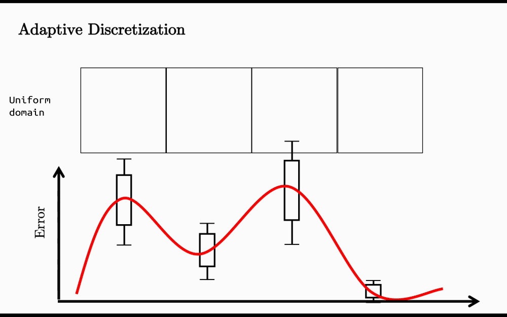
Adaptive discretization for spatial zoning
Summary
Space
   ↓
Occupant Feedback
   ↓
Variance Analysis
   ↓
Adaptive Subdivision
   ↓
Human-Centric Zones
What is Adaptive discretization
Adaptive discretization is widely used to efficiently convert continuous domains into their discrete representations. Continuous domains contain infinitely many possible values, such as real numbers. In contrast, a discretized representation consists of a finite number of cells or elements that approximate the original domain.
The key idea behind adaptive discretization is that not all regions of the domain require the same level of detail. Instead of dividing the domain uniformly, adaptive discretization allocates more cells to regions with higher approximation error and fewer cells to regions that can be represented accurately with larger cells. For example, if a particular region exhibits a high error, that region is further subdivided into smaller cells. This process continues iteratively until the error is minimized and more evenly distributed across the entire domain (see the figure below).
In spatial Analysis
I used the same concept to divide spatial zones into subzones based on the variance observed in the collected data. For example, in an open office space with only two air-conditioning outlets, we noticed that occupants sitting near the outlets often feel cold, while occupants just a few meters away report feeling comfortable or even hot.
Traditionally, buildings are divided into perimeter and core zones for analysis and control. However, such a coarse representation often fails to capture the actual spatial heterogeneity experienced by occupants. Human perception of thermal comfort can vary significantly within the same zone, even across relatively short distances. Adaptive discretization provides a data-driven alternative by allocating more spatial detail only where it is needed.
Conceptually, this is similar to quadtree decomposition, where regions with greater variability are recursively subdivided while more homogeneous regions remain unchanged. The result is a spatial representation that better reflects the underlying phenomenon without unnecessarily increasing computational complexity.

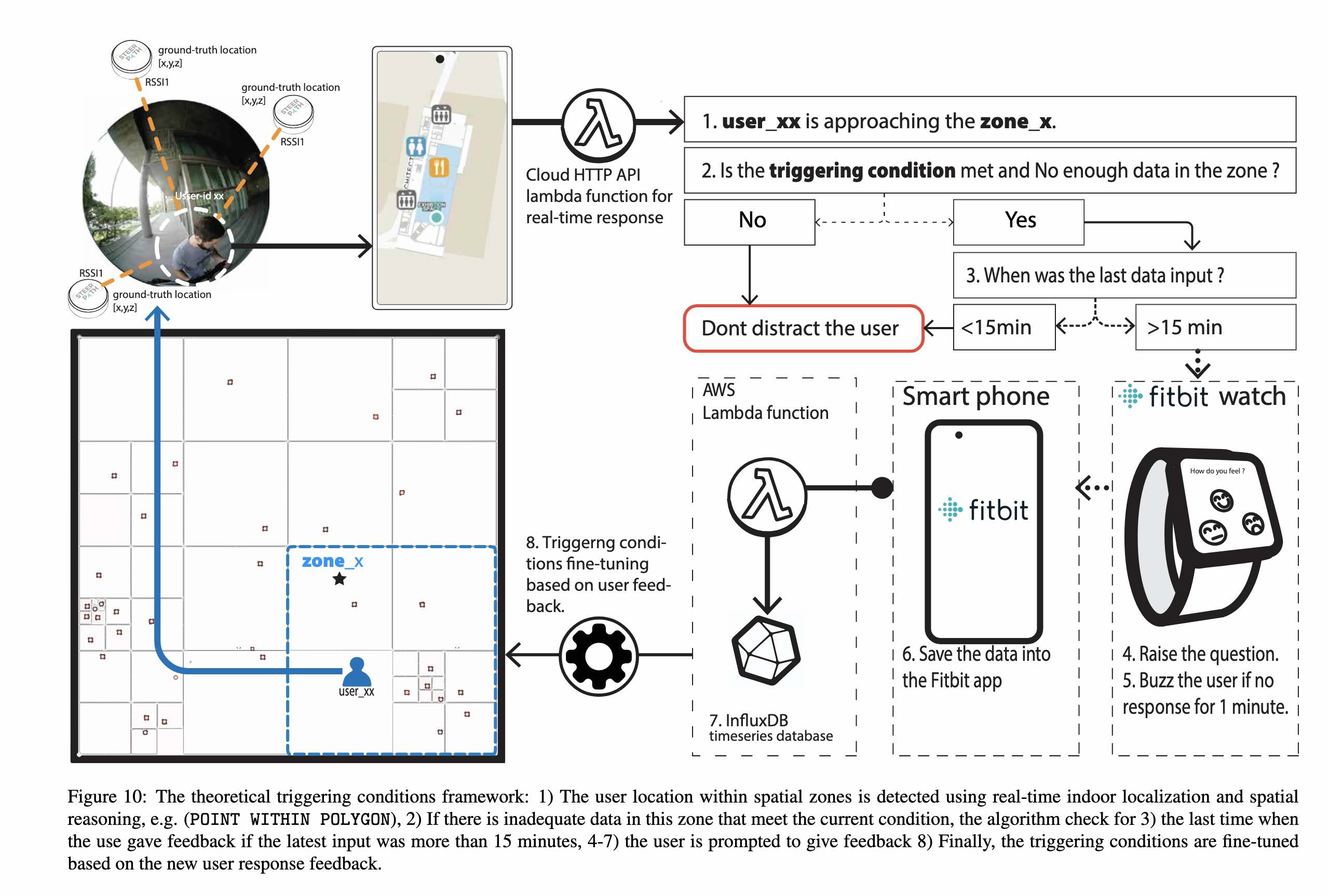
Interestingly, the same concept inspired some of my research on adaptive spatial zoning. Instead of assuming fixed perimeter and core zones, we used data collected from smart watches and IoT devices to identify zones based on how occupants actually experienced the space. You can find more details in these studies here and here.